Several entities, including Earth Systems management LLC, college students from the Eastern Shore, and ODU students, have been hard at work setting up a Hydrone as part of the Elizabeth River Project. The drone was set up and deployed last month on the Eastern Shore of Virginia. The Virginia Institute of Spaceflight and Autonomy (VISA) has been supporting the team with funding for student interns and equipment for the project.
At the same time the Hydrone was being set up and deployed, ODU staff and students collected aerial drone imagery to build a mosaic air photo and 3D model of the area to be surveyed. The imagery and 3D data collected will help document changes in the site restoration and eco-friendly construction for demonstrating resilience and adaptation to sea level rise.
Great news as the team has officially completed the first phase of testing!
Right now, the team is in the process of analyzing the Hydrone data and their adequacy to stitch together bathymetry (depths) of the creek with the topography from the UAV drone.
Meanwhile, the team determined that the remote operation of the drone could be improved by adding autonomous operation computer. An ODU engineering professor is assisting with this, but so far the team has only just been able to order parts.
What can the Hydrone do for the environment?
Potential applications of the Hydrone platform and sensors are growing. The Hydrone can quickly collect bathymetric data in shallow areas that are too confining for small boats and can be easily deployed from the creek or riverbank without requiring a boat ramp. With the addition of autonomous navigation, the vessel can also map areas with a systematic coverage and reduced gaps. Shallow creeks and marsh channels are important environments to map for monitoring sea level rise responses, assessing channel navigation and dredging operations, and capturing baseline fine-scale depths for flood simulation models.
In the nearshore environment adjacent beaches, the Hydrone’s echosounder can derive profiles to map sediment changes, movement on- and off-shore sand bars, and “ground truth” and calibrate wave models. The team is also exploring the platform for high-resolution water quality sampling before and after flooding and to monitor harmful algal blooms (HABs) and as a platform to inventory submerged aquatic vegetation (SAV).
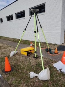
The NOAA National Geodetic Survey (NGS) survey branch office in Norfolk has assisted the team with improving the survey reference data at the nearby site, by GPS locating the targets and also helping ODU establish new accurate benchmarks on campus at Kaufman Mall and the ODU Sailing Center. These will enable future mapping and high accuracy elevation data collection useful to storm surges, sea level rise, and subsidence research and teaching.
Next steps
The next step is to either repeat the collection at ERP site with greater detail with equipment as is, or to await the new autonomous equipment add-on and testing. The team also plans to redeploy the drone very soon.
Click here to see a video of the Hydrone in action: https://youtu.be/eRwE4OHgaKk

The GPS surveying of a Norfolk Benchmark at Colley Avenue and 47th Street


